
An Art Hunt

By Dee Nechkash
Wisconsin’s Driftless region is best known for its scenic hills and valleys, meandering rivers and winding roads that lead you to remote destinations with beautiful scenery. Scattered throughout the region are murals painted on the sides of buildings, retaining walls and parking lots to showcase artistic talents, spotlight a community’s achievements and promote local attractions. Some are clearly visible from the main thoroughfare in the community, but others are hidden down side streets and alleys, available only to those who take the time to explore beyond the highway.
With a well-planned day trip, you can catch a glimpse of all of the Southwest Wisconsin murals in one day. But taking the time to stop and absorb the details in each piece of art, exploring the community it was created for and snapping some photos to share with others is the best way to experience these magnificent paintings. With Viroqua featuring more than a dozen murals of its own, it is a worthy destination for your day trip.
Check out the map of murals in the region and add them to your destination planning. EXPLORE SWWI MURALS Please note that this is not an all-inclusive list; it is just a start. Check back to this link periodically and I’ll add more as I come across them.

Before I started this article, I knew of several murals in the area. Some, like the Muscoda morel scene, I’ve seen many times on my frequent pass-throughs of the community. I love that they feature that artwork every year as people visit that municipal building to buy and sell morel mushrooms. It is great placement in the Morel Mushroom Capital of Wisconsin.
My husband and I took advantage of the beautiful weather on Easter weekend and drove to Viroqua to see some of their murals. We knew there were at least three in the community, but we didn’t have any idea there were so many! We found ourselves driving down every street just to check the alleys for artwork. It was like an Easter art hunt! The artists are extremely talented, too. They implement local faces and attractions in their designs and showcase creative and unique artwork. I was surprised to come across a “Take A Look” sign on a post near the road, then an entire alley filled with mini murals depicting the city.
We knew there was one in Westby, approximately 5 miles north of Viroqua, and another in Coon Valley, another short drive from Westby. Westby’s book scene at their library contains story-inspired artwork that makes you want to re-read the classics. Coon Valley’s wings encourage you to get out and snap a picture of your most angelic moment. Both were painted by Sarah Pederson of Lucid Painting, who also paints murals in many other communities in the Vernon County area.
From business welcomes to historic scenes of the region, the murals are worth a day trip throughout the region. They tell the community’s story, provide a unique experience and create an opportunity for you to stop and stretch your legs while admiring the creative display. Take a moment to connect with the community and learn a little more about their history, their livelihoods, their proud moments and traditions.

Avoid Muddy Trails for Nature’s Sake
By Dee Nechkash
Exploring the natural beauty of Southwest Wisconsin should be done without leaving your mark. The weather is finally shaping up into a beautiful spring. Trees are budding, migratory birds are returning and plants are starting to sprout out of the earth. It’s a magical time of year to witness the landscape awakening from a cold, snowy winter.
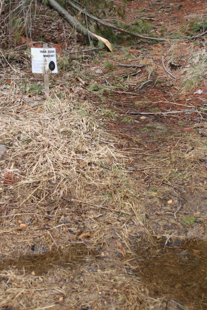
Just as you already know you shouldn’t carve your name into trees along the trail and you should take your trash and waste with you, you should also know that walking, biking and horseback riding on muddy trails can permanently damage the trail surface, contributing to erosion and creating hard-to-fix trails.
The rule of thumb is: if you are leaving visible bicycle ruts, deep footprints or hoof tracks, the trail is too muddy for recreation!
Muddy trails should be avoided altogether, but if you come to a muddy section on an otherwise dry trail, you can minimize your impact by continuing through the center of the trail, which reduces trail widening. Bikers should dismount and tread lightly down the center. And if there are fallen trees over the trail, walk over them if possible to prevent widening the trail.
For more details on trail etiquette, visit https://dnr.wi.gov/files/PDF/pubs/pr/PR0472.pdf.
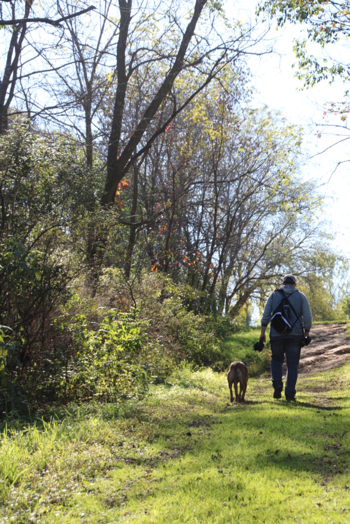
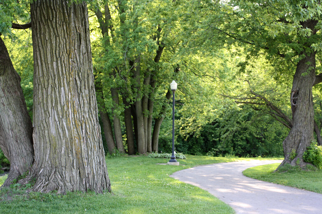
The recent rains shouldn’t deter you from getting outdoors this spring. There are many paved and gravel trails locally that are ready for you to enjoy, including:
- Platteville has the David Caney Rountree Branch Trail, a paved and lit trail that follows a trout stream on the outskirts of the city,
- Mound View Park in Platteville has a paved loop as well as a gravel path that connects to the Rountree Branch Trail.
- The paved Mound View State Trail connects Platteville to Belmont.
- In Belmont you can pick up the Pecatonica State Trail, a limestone surfaced multi-recreational trail, which connects to Mineral Point and Monroe. It joins the Cheese Country Trail in Calamine.
- Darlington’s Walking Trail is a paved, lighted walking trail following the Pecatonica River from Black Bridge Park to Riverside Park.
- The Military Ridge Trail in Dodgeville is another great trail option.
- Richland Center has the 14.3-mile paved Pine River Recreation Trail that follows the waterway from Krouskop Park on the north side of Richland Center to Lone Rock.
- Viroqua and Westby are connected by the paved Coon Prairie Trail.
O’Leary Lake Offers Opportunities
There’s a tiny little lake in the southwestern-most corner of Wisconsin that provides a multitude of outdoor recreation opportunities year-round. O’Leary Lake, located approximately 3 miles from the Wisconsin-Iowa bridge at Dubuque, Iowa, is a 7-acre, shallow lake with a 14-foot depth at its deepest point. Most of the lake is much shallower. The lake borders the Mississippi River.
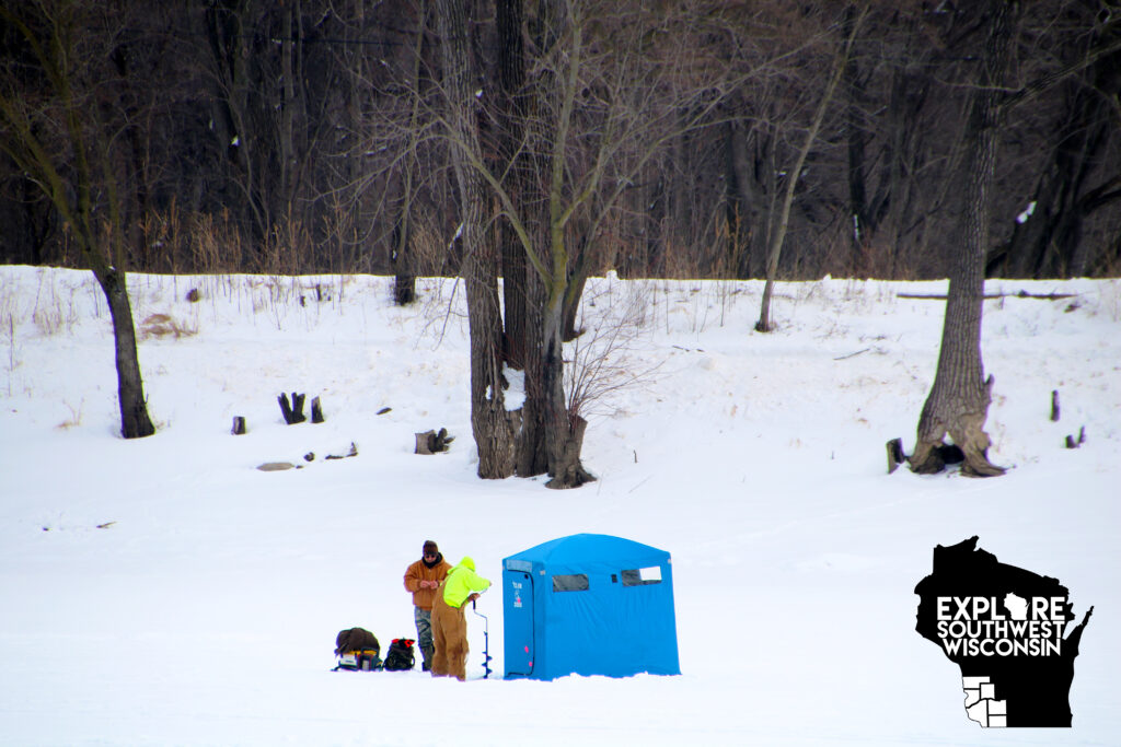
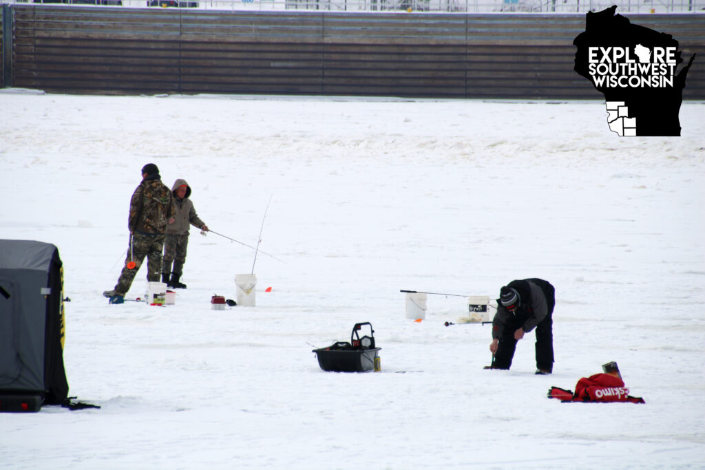
I ventured to the lake in hopes of finding people enjoying the beautiful winter day, and I lucked out! The place was hopping with activity. Groups were fishing on the ice, both on the lake and on the Mississippi River; people were walking their dogs; some were snowshoeing; others were photographing the eagles swooping down for fish below the dam.
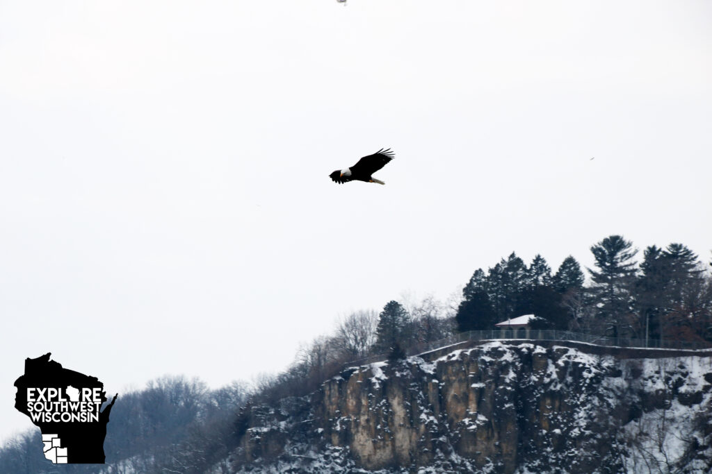
A pair of photographers were stationed closest to the dam watching the eagles come and go. I chatted with one of them as he walked back to his vehicle for equipment. He said he and his daughter were from Madison and were spending the day together photographing eagles. They had already been to several spots in Iowa and Illinois and this was their last stop of the day. He said it was the best spot they had found for watching the active eagles.
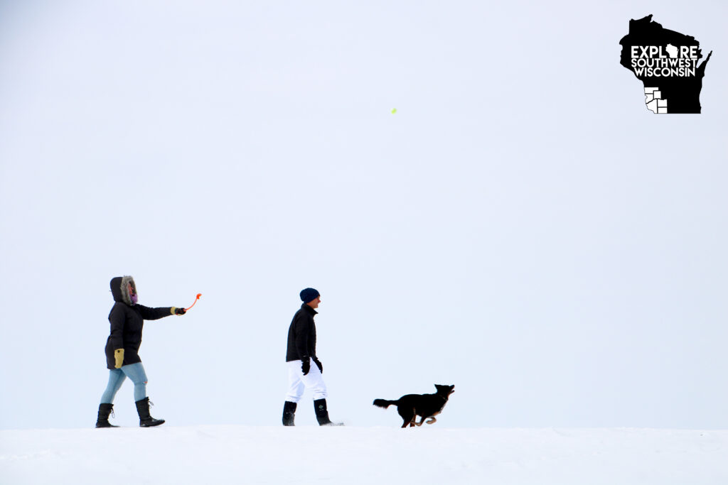
I caught myself watching a couple walking with their dog. They brought a ball with and the dog was an excellent fetcher. Their position on the berm and the bright colors of the dog’s toys made for a great winter action shot.
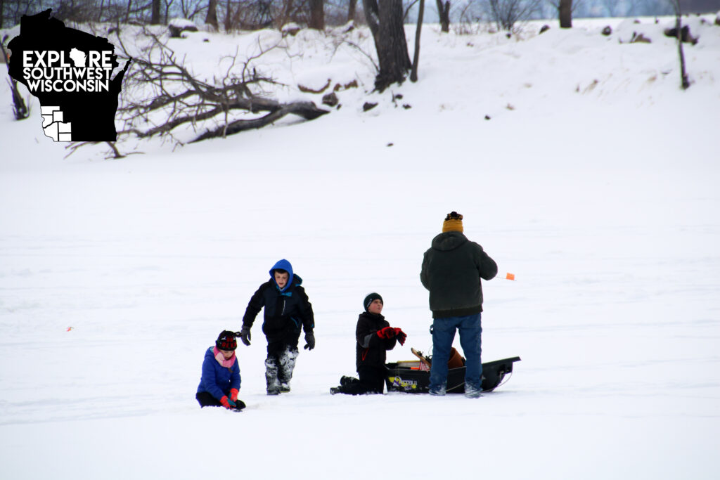
On the ice of O’Leary Lake, a dad and three kids set up their fishing area. The dad would drill a hole in the ice and the kids would remove the slush so the dad could set up the tip-ups. The kids had lots of questions, but they were eager to help.
There were several others fishing on the ice. They all seemed to have slightly different set-ups, from sitting on a bucket to standing to using a shanty. There is no right or wrong way as long as you’re dressed warmly, follow the fishing regulations and stay safe out on the ice.
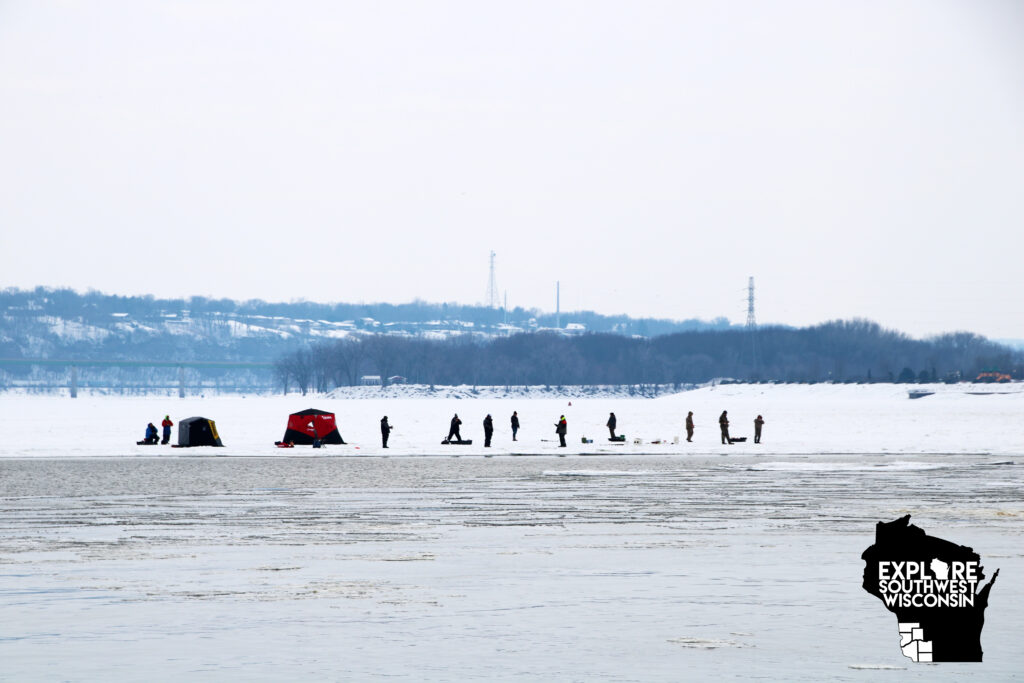
As I was getting ready to leave, a man drove up to me to ask if I’d seen the group out on the river yet. Yes, I did notice the brave souls fishing way too close to open water for my comfort. I drove out to the barge on the southwest side of the lake and stood on the snow-covered rocky shore to get a closer look. Even with all of the cracks in the ice, fishermen didn’t seem too concerned about drilling more holes and adding more people to the shelf of ice. It was a risk I wasn’t taking.
Leaving the park, a carload of people of all ages were strapping on snowshoes to explore the area with their pups. They had at least eight people – grandparents, parents and children. They had so much energy. You could just tell they were going to have a great time.
O’Leary Lake may not be large, but it does have a lot to offer. It is bustling with activity year-round due to the permanent barge set up where the lake meets the river. In summer you can watch the boats and barges maneuvering the dam. A variety of birds can be seen feeding in the backwaters of the Mississippi River. And O’Leary Lake is a great place to spot turtles sunning on fallen trees. The bridge at the entrance to the lake is also a great place to watch the trains, just stay out of the way of traffic. And, when the lake and river aren’t covered in ice, there is a boat landing for kayakers and fishing boats to get to the Mississippi River and backwaters.
Give it a try. It is located on Eagle Point Road south of Kieler, exit 3 on Hwy. 151. If you are coming from Dubuque, use exit 2 and follow Badger Road north (left) to Eagle Point Road, then turn west (left) to get to the lake.
Take the Scenic Route

By Dee Nechkash
Maybe you’ve seen the brown “Rustic Road” sign and didn’t quite know what it meant, or saw it and told yourself you’d give it a try some other day when you had more time. These little gems scattered all across Wisconsin – 122 of them to be exact – are worth the detour.
These Rustic Roads are an opportunity to slow down, enjoy the natural and historical beauty of the area and view parts of Wisconsin that have been untouched by the fast-paced world we live in.
Only 61 of the state’s 72 counties have designated Rustic Roads. Every Rustic Road is unique, but they all have outstanding natural features, are lightly traveled, are not scheduled for any major improvements and are at least 2 miles long. Some are paved, but some are gravel or dirt. They provide a closer look at rugged terrain, native vegetation and/or wildlife and spectacular agricultural vista views. The maximum speed limit on a Rustic Road is 45 mph.
There are six Rustic Roads in the six-county region of Southwest Wisconsin.
Grant County

- Rustic Road 70: Approximately 10.1 miles from U.S. 61 at Liberty Ridge Road; portions of Hill Road, Ridge Road, Sleepy Hollow Road, Scenic Road to County E.
- Rustic Road 99: Approximately 3.4 miles along segments of River Lane, Slazing and Brewery Hollow roads forming a loop off WIS 133.
- I personally love this segment! It’s a very hilly, curvy route between Potosi and the Mississippi River and leads to a great campground and boat landing at the Grant River Recreation Area. The Rustic Road loops back to the Wisconsin Great River Road, another beautiful driving route showcasing the small communities along the Mighty Mississippi.
Iowa County

- Rustic Road 75: Approximately 3.7 miles following portions of Ogden Road, Bromley Road and Turnbull Road between County A and County G in the town of Mifflin.
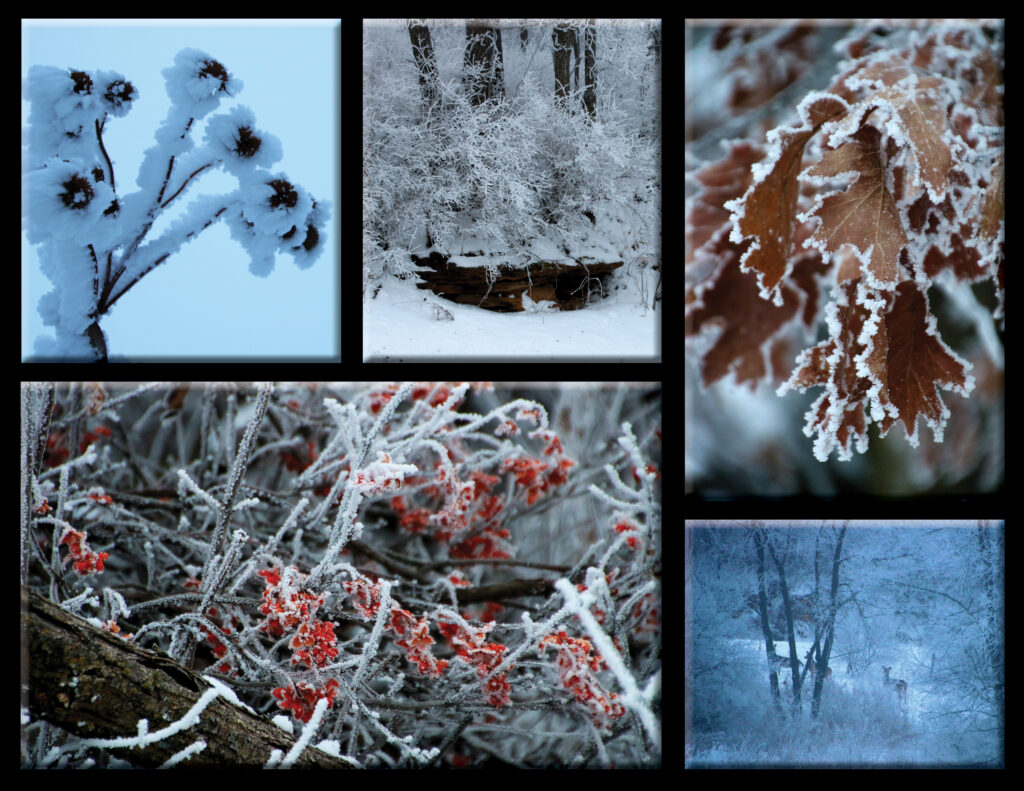
- I took a chance and texted my boss that I would be a wee bit late because the frost was super pretty and I was road tripping around the area snapping pictures before work. Lucky for me, my boss knows I love photography. Plus we didn’t have anything urgent to attend to and I had a few hours of comp time to burn anyway. I made my way to this Rustic Road because it was close enough to home, but still someplace I hadn’t visited much. Ooo la la! Every little turn I took I was stopping to get out and take another picture. This little segment is beautiful in summer, too, but I especially love it in winter! Added bonus was all of the wildlife I saw – a herd of deer, a fox and many birds flitting in the fresh snow on the trees. I’ve previously been on this Rustic Road because there is a geocache hidden along it. (Not sure what a geocache is? Click HERE for more info.)
Lafayette County

- Rustic Road 66: Approximately 7.5 miles just off County W in the town of Benton, following portions of Buncombe, Kennedy, Beebe and Ensch roads. This route features an abandoned lead mine on Kennedy Road and winds through the Driftless valleys following the Galena River and crossing Scrabble Branch, Bull Branch and Coon Branch, all with fishing opportunities.
- My husband and I ventured to this Rustic Road last fall and actually spent quite a bit of time in the area. Instead of just driving through, Corey brought his fishing gear and tested the waters, successfully reeling in a few fish. There are some beautiful landscapes in this ridge and valley route that meanders along a few different streams.
Vernon County

- Rustic Road 55: Approximately 2.8 miles of Tunnelville Road, beginning at its junction with WIS 131 to its intersection with County SS.
- I haven’t visited this route recently, but when I lived in Viola, it was just a few miles away, but had the feeling of being a whole world away. Following the Kickapoo River, the terrain includes marshy areas, woods, hills and farmland. It is especially pretty decorated in autumn’s vibrant rainbow. Nearby fields are managed by Amish families and corn shocks are commonly seen all throughout Vernon County.
- Rustic Road 56: Approximately 8.6 miles encompassing portions of Dutch Hollow Road, Sand Hill Road, Hoff Valley Road and Lower Ridge Road.
I feel that Richland and Crawford Counties should have designated Rustic Roads. Maybe they just have too many to choose from. There are plenty of little-traveled roads with spectacular sandstone features that would warrant this rustic designation.
To view the interactive map and learn more about each route, go to https://wisconsindot.gov/Pages/travel/road/rustic-roads/default.aspx.

I was fortunate enough to order one of the Rustic Roads printed guides in 2018 before they discontinued printing. Now you can download a PDF copy or access all of the information on the interactive Wisconsin DOT website, but, to me, nothing beats having the printed copy in the glove box when you need it! I’m definitely the paper map and hard copy brochure type of person. It just makes travel plans easier for me.
The Rustic Road guide also includes a checklist so you can keep track of which routes you’ve already visited. My tally is at 8 Rustic Roads throughout the state. I have so much more to explore!
Winter Hiking Adventure
A Snow Day in Governor Dodge State Park

By Dee Nechkash
The weather can change your plans pretty quickly. Friday I anticipated heading two hours away to explore some ice features at a couple of parks I’ve never really explored, and then a snowstorm pops up and I’ve got a whole weekend with nothing planned except shoveling the driveway after the snow stops.

Lucky for me, I live close to some exceptional state parks! The Wisconsin State Park System has some real gems, and there are a handful of spacious, diverse properties begging to be explored. I decided to head east to Governor Dodge State Park. While it is the park I am most familiar with, it is massive – more than 5,000 acres – and I have barely scratched the surface on checking it out. This park has TWO lakes, approximately 27 miles of hiking trails, 24 miles of horse trails and 8 miles of off-road bike trails. The property was once farmed and mined. It has caves and waterfalls, magnificent bluffs and extreme valleys. The terrain is sometimes hilly, rocky, wooded or open prairie. It is that “little bit of everything” catch-all type of park, where you can hike, bike, kayak/canoe, fish, ski, rock/ice climb, swim or ride horses.
Usually I visit the park for the fall color or to dip my toes (or kayak) in the water. But this time the temperature was hovering around 30 degrees, there was a base of 6-8 inches of snow covering the ground and icicles hung from the sandstone. Governor Dodge State Park is absolutely stunning in winter!

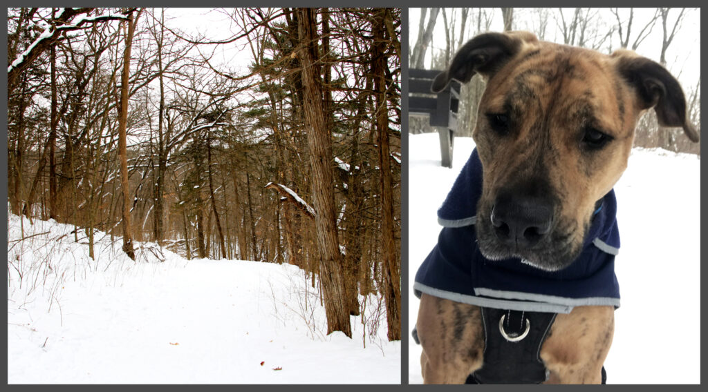
My pup, Scout, needed out of the house, too. I tried out the waist leash and found that it was a great option to let him explore, but stay close to me and be reeled in when we encountered others on the trail. Added bonus: he helped pull my out-of-shape body up the steep incline!
Since I couldn’t get my icy landscapes I had planned on exploring, I thought I’d try Stephens Falls to see what the ice looked like there, if any. The falls has a great overlook before a rock-stair descent to the streambed. My first glance was accompanied by my jaw dropping. Not only was there an entire sandstone bluff covered in ice, but there were people actively climbing the ice wall! The waterfall doesn’t have a significant flow, but the ice built around the base was worthwhile.
Because there were so many people in the area, and I was wrangling a 3-year-old pup while trying to take pictures and not fall in, we didn’t stay at the falls for long. We ventured out on the Stephens Falls Trail, which crosses a couple footbridges and meanders along the stream in a deep canyon with large boulders scattered throughout. The sandstone cliffsides had a few dangling icicles and remnants of summer ferns. A few leaves still fluttered about, no longer trapped in crevices in the rock. We met many people along this trail as it is easy to traverse and extremely scenic.
At the intersection with Lost Canyon Trail, I chose the longer of the routes, anticipating an invigorating trek through the snow. The trail remained in the valley with little for inclines until the path veered up pretty drastically. There were many breaks taken and lots of huffing and puffing. There may have even been a text message to my husband to let him know where to find me and the dog in case I didn’t return. I wasn’t sure my body was going to make it. But, my trusty steed kept tugging me along and didn’t complain when I insisted on stopping often.
Along the cliffside part of the trail, we were able to watch two pair of cross-country skiers pass by. Scout really wasn’t sure what to think about them gliding instead of walking, but he behaved very well. We stopped at the Wilson Spring House, which didn’t have much water at this time, and took a break overlooking the Stephens Falls Trail where a bench is conveniently located for a great view point. We took our time and made the 3-mile trek with lots of stops for photos in just over 2 hours. It was really quiet and peaceful on the trail, a nice change from walking in town. The trails were well maintained for winter exploring, too.
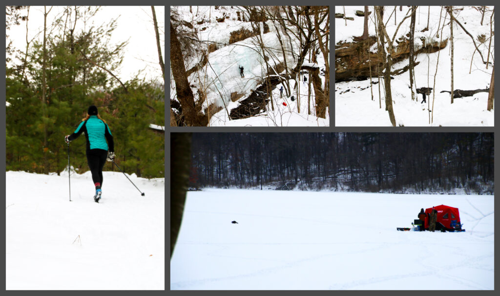
Before leaving the park, I wanted to drive to both of the lakes to see if anyone was ice fishing. It was late in the day and most of the groups seemed to be packing up, but there were a few shanties on each lake. I even saw a raccoon scurry away from one ice shanty, probably stealing their catch of the day!
The state parks aren’t just for summer fun. Get out and explore the history, the nature and the beauty in all seasons. If you need more info on Governor Dodge State Park, check out the Wisconsin Department of Natural Resources website, https://dnr.wisconsin.gov/.
Exploring SWWI Autumn
Crawford, Grant, Richland & Vernon Counties
My morning started out with a text letting my grandparents know that I was running late. I only made it 20 miles from home before I found jaw-dropping natural beauty. No surprise there. My gas tank was full and my camera was ready to go on another day-long tour of fall color. This time my focus was on the western side of Southwest Wisconsin. After spending the previous day exploring Lafayette and Iowa counties, I knew I’d discover a few hidden gems on my hour-long route to the Boaz area, but I wasn’t expecting what I found.
Grant County can really surprise you. It features plenty of rolling hillsides planted with crops, most of which are due for harvest this time of year. But it also has deep valleys with amazing rock outcroppings. With a name like Bluff Road, who wouldn’t want to stop to see where the name came from. Not all roads in the area are named for natural features, but this one most definitely is, and you find out why within just seconds of turning onto it. Bluff Road is north of Montfort off Cty. Hwy. I.

The magnificent gray rock protruding from the hillside was framed with some fall color, but the awesome display was on the adjacent hillsides, which were sprinkled with a wide variety of colors. I stopped at the Blue River public fishing area and parked to take some pictures. I didn’t have the bright blue sky today, but at least it wasn’t raining.
I meandered through the back roads, using my detailed Grant County map (free at the Platteville Regional Chamber) to find my way back to my northerly route. I was on roads I had never seen before and around every corner I was stopping to take a picture. With the fall color aside, this is a beautiful area any time of the year!
Making my way north, I made a couple of stops outside of Muscoda on both sides of the river. I had no problem pulling over to let people pass me; I was taking my time!
What I love about my grandparents is when I tell them I want to make a 100-mile trek in one afternoon, and that I plan to stop a LOT to take pictures along the way, they are up for it and even enthusiastic about the sight-seeing adventure! They even fed me lunch before we left, too!

Our first destination was Gays Mills. It is prime apple season and Gays Mills is THE place to go for apples, baked goods and shopping galore with so many orchards lining the highway! I guess everyone and their brother thought the same thing because the parking lots were FULL and people were lined up waiting to get into the stores along the hilltop Hwy. 171. We found a parking space at the James Fleming Orchard and I got out to take a few quick pictures. It is a beautiful orchard with a variety of apples growing near the parking lot. My grandparents said they will make a weekday trip to pick up their supplies; it wasn’t worth waiting in line on such a busy weekend when they live so close.


As we trekked on, we stopped at the wayside and historical marker for a few pictures. The marker described the apple growing conditions and the history of the orchards in the Kickapoo Valley area. The windy, steep hill descending into Gays Mills was similar to an amusement park ride – thrilling. My grandpa even guided me to the new part of town (built after extreme flooding ruined the city) to show me where he goes to get his hairs cut (yes, he insists on getting more than one cut).

As we pulled into Soldiers Grove, we stopped to photograph a pair of horses with gorgeous fall color behind them. They entertained us for a few minutes and then we moved on. I already thought I had a plethora of fabulous photos for the day, but they just kept getting better and better the farther north we went.

Another stop we made was the school and Banker Park in Viola. I used to live near the park and stopped to see the improvements they’ve made. They are continually working to make the Kickapoo River a destination. It is a fantastic venue for canoeing, kayaking and tubing. The whole community comes alive for the Viola Horse and Colt Show in September!

We followed the Kickapoo River upstream to LaFarge. Grandpa was well into his stories about where he used to drive truck to deliver pop to the gas stations and restaurants. It was interesting to see how some of those buildings from his youth were still standing and recognizable, while others had been long-gone. He recited names of people he would deliver to and some of their order details, and even shared stories about the brakes in his truck going out! We stopped briefly in LaFarge to photograph the beautiful mural on the side of a building.


As we got closer to the Kickapoo Valley Reserve, the hillsides transformed into the most magnificent fall display any of us had ever seen! My grandparents were telling me to pull over every couple of minutes because it was so photo-worthy! Along the way I even got a lesson from my favorite retired science teacher! He can’t pass up a learning moment, and helped me better understand about the different types of oak trees based on their leaf shape and bark texture. And every time I got out of the car to take a photo, grandma would roll her window down to take pictures of me taking pictures. They are quite the pair! They made the trip very entertaining!
The Kickapoo River bridges between LaFarge and Ontario are magnificent, arching high above the wild river. We stopped at Boat Landing 5 for my grandparents to reminisce their canoeing stories and for me to get some beautiful sandstone cliffside photos along the river.
When we pulled into Ontario, I knew we were close to another state park: Wildcat Mountain State Park. I hadn’t been there since 2011, as part of my state park tour (yep, I’ve been to all of Wisconsin’s state parks). It was the heat of summer during my last visit, so this was a treat to see the park in full autumn color!
As we made our way up the steep, curvy highway, the canopy cast a golden glow. This is special because it was an overcast day. I can only imagine what it would have been like arriving there on a cloudless, blue sky day! We turned off to descend to the boat landing first, then backtracked to the main entrance and grabbed a map of the park. We took the gravel road past the campground, amphitheater and picnic area to the group campsite and turned around, stopping several times for pictures of the dense forest topped with golden leaves.


We drove to the much busier side of the park, the observation point. Grandma and I followed the short path to the overlook for a magnificent view of the Kickapoo River meandering through farmland and a rainbow of fall foliage. I took a few moments to show Grandma the Travel Wisconsin Selfie Stand and we posed for a few photos.
Leaving the park, we pulled off right away to take more pictures looking back on the hillside we just came from. I couldn’t get enough of the myriad of colors.

On our way to Hillsboro, we took a few county highways I had never been on, but Grandpa knew well. Just as we crossed from Vernon County into Richland County, we stopped near an Amish farm where they had a field of corn shocks framed by the vibrant hillside. The farmland in the Driftless region really does have a beauty all on its own.

From Yuba we made our way to Rock Bridge for our last stop of the day. We checked out the new-ish boat landing with an accessible dock and then walked through the tunnel to see both sides of the natural bridge over the Pine River. If you haven’t stopped at Pier County Park off Hwy. 80 before, it is worth a stop. They have campsites available and it’s a great place to fish or get in the water (when warm enough). Climbing the stairs to the top gives a great view of the nearby farms and marsh areas along the river.
As we pulled into my grandparents’ driveway, I snapped one more shot: the fall color surrounding what my grandparents call the Schoolhouse. With both of them retired school teachers and building their home at the site of the Ryan School in Richland County, it is only fitting that they have a collection of school memorabilia.
If you missed the peak color this year, mark your calendar for the first two weeks in October next year and plan for a Southwest Wisconsin road trip! And grab free maps from the Travel Wisconsin Welcome Center (locations in Platteville and Prairie du Chien) to help guide you on your way. I especially like the Driftless Wisconsin map (it shows all of the backroads in Richland, Crawford and Vernon counties, as well as a little beyond those borders) and the Grant County map (which not only features every road within the county, but also the waterways and public access areas).
Note: The State Park Annual Pass is a gift my brother gives me every year. The $28 a year (seniors only pay $13) gets you access to some of the most beautiful locations across the state!
Exploring SWWI Autumn

Lafayette & Iowa Counties
By Dee Nechkash
Favorable autumn weather in Wisconsin never lasts long enough, which is probably why it is the most coveted season for this state! The fall colors did not disappoint this year, although they only lasted a few short weeks. Whether you were looking for reflective surfaces to frame a photo of vibrant fall color or entire hillsides dotted in brilliant yellows, oranges and reds, you have plenty of opportunities in this region.
I spent an entire weekend on the road documenting the change of season. My husband and I ventured through parts of Lafayette and Iowa counties on Saturday, him with a fishing pole, me with my camera. He managed to reel in a perch, a large mouth bass and a small mouth bass, all from different bodies of water in the region. While he casted, I hunted for just the right locations to get the bold colors on the horizon.

(Dena Nechkash photos)
We took a few Rustic Roads to start our trip. These lightly traveled country roads provide a serene, peaceful experience, no matter what the season. Find the PDF version of the guide here. The Rustic Roads program, started in 1975, now features 122 unique roadways.
Rustic Road Route 66 in Lafayette County meanders near the Wisconsin-Illinois border southeast of Hazel Green. We took Buncombe Road off of Hwy. 80 south of Hazel Green and slowly wound through the deep valleys, crossing several waterways – the Galena River, the Scrabble Branch, the Bull Branch and the Coon Branch – and branching off to other winding country roads. Along the way we saw several fishermen enjoying the beautiful weather and scenery. We were not alone in our scenery drive and met others out catching the fall color, too.
Buncombe Road turned into Beebe Road, which climbs a steep hillside and levels out with a beautiful birds-eye view at the state border. We watched farmers harvesting soybeans, creating a dusty haze of progress. Doubling back to Kennedy Road, we sought out the tailings piles of an abandoned lead mine. A sign marked its location at a particularly scenic and windy spot in the road.


We headed northeast, aiming for Woodford, a community neither of us had explored in the past. The map showed a park along the Pecatonica River, which could meet both of our goals – reflective fall photos and fishing opportunities. Blackhawk Memorial County Park in Lafayette County was spectacular! If you didn’t know it was there, you’d drive by like we did the first time. As you enter the park, you are greeted with a lengthy memorial sign describing the bloody battle that took place nearby. A monument is placed at the exact location in the park with an area to sit and reflect.
This park was magical in its own way. A one-way road skirts the edges of two lakes and the Pecatonica River, showcasing some fantastic rustic campsites with waterfront access. Imagine setting up your tent with your fishing line casted just a few feet away! It is a hidden gem we anticipate returning to explore further!

Trekking northward, we drove to Argyle and nearby Yellowstone Lake State Park. This was the opposite of our last stop – it was teaming with crowds of people. We didn’t stay long because there wasn’t really anyplace to park and explore without swarms of people nearby. It probably isn’t usually like this, but the COVID virus has out-of-state visitors looking for destinations to escape their closed-down states.
Don’t get me wrong, the scenery was beautiful here! They have a great pull-off area with views of the whole lake and the speckled hillside beyond. There were boaters and swimmers enjoying the potentially last warm weekend of the year.
We did track down the Travel Wisconsin Selfie Stand while in the park. It is across from the main entrance. We snapped our picture, flicked a few of those Asian beetles off our clothes and got back on the road.

Taking some lesser-traveled routes, we wound our way through Iowa County (with a little bit of Dane County) toward Governor Dodge State Park just north of Dodgeville. This is one of our favorite state parks and we visit it often, usually with the kayaks and fishing poles. It is our favorite because of its proximity to our hometown (Platteville) and stand-out features like well-stocked lakes, multiple waterfalls, caves, prairies and excellent hiking trails for all levels. There are even horse trails and plenty of snowshoeing and cross country skiing options in winter. The ice fishing is favorable, too.

I left my husband to fish at Twin Valley Lake, the farthest one back from the entrance, then looped the park. I may have told him I’d be back in 30 minutes and knew that wasn’t going to be the case. I did text him when I made it to Cox Hollow Lake, approximately 35 minutes later! It was just more fishing time! The scenery was great around every bend and the shutter on my camera was doing a fantastic job documenting the beautiful scenery all around me. Another 45 minutes later and I headed back toward Twin Valley Lake. He had caught a fish, so he wasn’t upset.

We weren’t done yet! We took Hwy. 23 north toward Spring Green and stopped at the Scenic Overlook to snap a few pictures. It wasn’t the best stop of the day; the House on the Rock viewpoints are all overgrown. The drive to Spring Green was fantastic, though.

Our destination was Peck’s Landing, just across the Wisconsin River before you drive into Spring Green. It’s a spot that has long been my favorite place to go, and it was my first time taking my husband with. There are sandbars to explore as well as pools where fish got trapped. We caught some reflection photos and watched someone playing with their dog in the water. We even used another Travel Wisconsin Selfie Stand! It’s just a relaxing spot, even with a bunch of people hanging around. There is plenty of space to spread out.

(Dena Nechkash photos)
Our last stop of the day was Avoca. My husband’s family has a cabin on the Avoca Lake and we wanted to stop and check it out one more time before it got closed up for winter. The Lower Wisconsin State Riverway access point is near the west end of the lake and its prairie trails provided a fantastic spot for sunset photos. The sun’s rays through the tall grasses and tree branches was mesmerizing.
It was a full day on the road, and we were ready to head home. We saw a few promising stops in the dimming light, ideas of where to stop tomorrow.
Hike the World’s Largest ‘M’
Written by Dee Harris
Located between Belmont and Platteville, near the border of Lafayette and Grant counties, you will find the World’s Largest ‘M’ on the hillside of Platte Mound, facing southwest. The ‘M’, which stands for ‘mining’, is a tribute to the rich mining history in the area, including the first mining college in Wisconsin, now known as University of Wisconsin-Platteville. The ‘M’ measures 241 feet tall and 214 feet wide and is open to the public daily, free of charge.
Traveling to see a gigantic ‘M’ on the hillside might not sound very interesting, but climb the 266 stairs to the top and the view of the tri-state area, including the bluffs of the Mississippi, is spectacular. This video gives you a brief look at climbing the hillside and the views, which get better on clearer days.
When you reach the top, consider a little hiking. If you take the trail south, you will find narrow paths that lead to rock ledges perfect for a private view of the horizon. A few of the boulders even pose a little challenge to climb atop. Please consider your own safety before attempting.
The trail heading north is much longer, approximately one mile to the end. It’s a nice hilltop trail through the woods (not much for landscape views) and requires climbing over some fallen trees. What is unique about this trail is that the landscape drastically changes within the woods, becoming limestone cliff walls with shallow caves. Look for fossils in the rocks and absorb the natural beauty of this location.
There are trash receptacles near the stairs. Please do not litter and ruin this property being open for the public. A small paved parking lot was added in 2018.
Getting to the ‘M’: From Hwy. 151, take Exit 21 and turn east onto County XX. Within a mile, turn left (north) on West Mound Road. The ‘M’ is approximately two miles ahead on your right.
To learn the history of the ‘M’, please go to https://www.platteville.com/visit/things-to-do/the-m.
Find Your Hyde-away
Written by Dee Harris
A simple little detour in the heart of Wisconsin’s Driftless area can lead you down a rabbit hole of exploration.
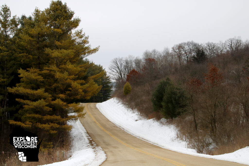
Traveling along WI Hwy. 14 in northern Iowa County, I turned south on Cty. Hwy. H a few miles east of Arena. I knew the general direction this road would lead me and that any off-shoot would wind me through hills and valleys in the general direction toward Ridgeway and Dodgeville, but I wasn’t exactly sure what all I would find.
The two-lane highway gets a little curvy, starting with a horseshoe bed within the first few miles. This isn’t a quick route, but one meant for enjoying and anticipating. A few more miles and there is a cheese factory, and then a shed with beautiful patriotic artwork.
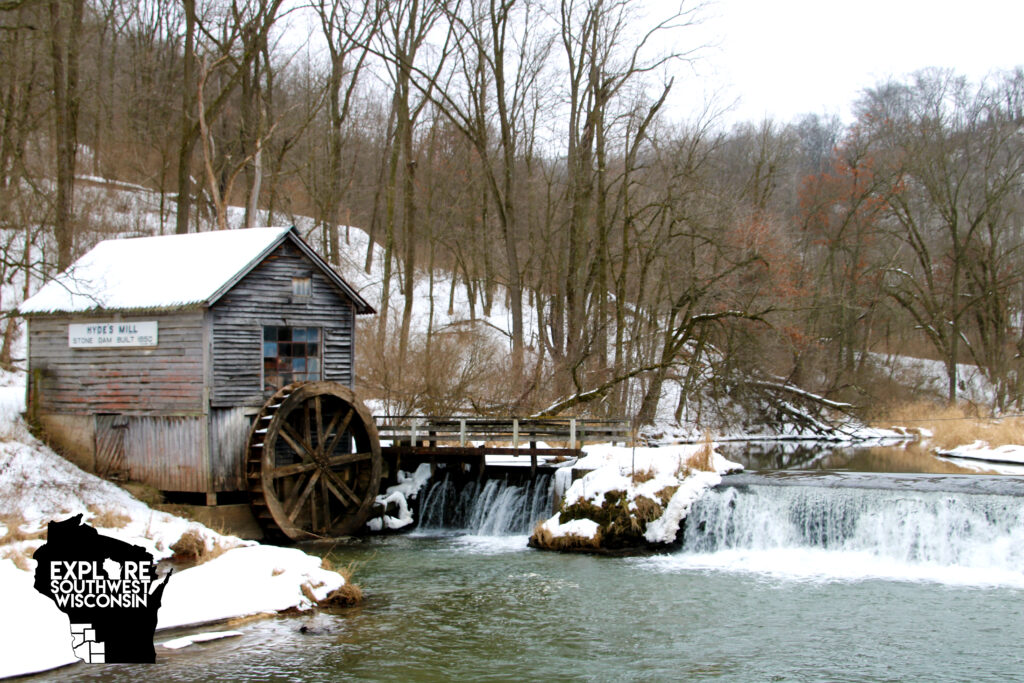
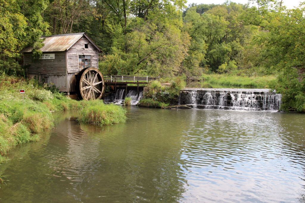
The main attraction I was looking for was Hyde’s Mill. This often-photographed landmark was built as a stone dam with a mill in 1850. The mill is not currently in operation, but its rustic beauty and rarity make it a worthwhile attraction.
Getting to the mill is simple. Follow Cty. Hwy. H south until the speed limit drops to 35 mph for the unincorporated Hyde. Turn left on Mill Road. The mill is approximately ¼ mile down the road, where the roadway bends.
There is a small parking area available, approximately 2-3 vehicles would fit. It is a low-traffic road, so parking along the shoulder should be fine as long as there is room for a vehicle to pass. Please abide by all fences, railings and posted signs. The mill is on private property and the family is allowing the public to be there as long as they view the mill from a distance. For special accommodations, talk to the family. Please do not ruin the experience for everyone else!
Looking for refreshments on your journey? The Hyde Store offers snacks and libations.
Meandering south again on Cty. Hwy. H, notice a blacksmith shop on the right a few miles past Hyde. Look for turkeys and deer along the roadway, maybe a fox or coyote will make an appearance, too.
Choose your route and explore the rolling hills of the unglatiated Driftless region. Cty. Hwy. H will take you into Ridgeway, which is along the 4-lane Hwy. 151. If you seek a more rustic route, try turning right on Cty. Hwy. Y, then right on Cty. Hwy. ZZ. This will take you to Hwy. 23 just north of Dodgeville and the winding roads through the hills and valleys offers breathtaking landscapes.
From there you can head toward your next destination. Just a short drive away is House on the Rock, Governor Dodge State Park, Bob’s Bitchin’ BBQ or Mineral Point’s High Street art district.
Recent Comments